
The area west of the Fleet River/New Bridge Street and south of St Paul’s Cathedral/Ludgate Hill can be broadly labelled as ‘Blackfriars’, although this well-known toponym has never been associated with an official ward of the City of London (the area is divided between the wards of Farringdon Within and, mostly, Castle Baynard).
Blackfriars has undergone a great deal of topographical change as a result of the railway line extending to Ludgate Hill, the creation on major new C19 roads including Victoria Street, as well as the very intrusive post-WW2 changes to Victoria Street, Upper Thames Street, Puddle Dock and White Lion Hill, which now resemble motorway access ramps. Despite this, the area retains a substantial number of narrow streets, lanes and courts from its pre-modern and early modern past.
Norman resettlement of this area comprised castles by various aristocratic families, the most prominent of which was Baynard’s Castle. The vicissitudes of medieval dynastic politics led to the property and surrounding soke eventually falling into royal hands, though disputes with the nobility over this, like many other fortified places, continued into the C13. Eventually, the land was sold to the Dominican order (‘Black Friars’ per the colour of their habit) to establish a major priory, with a reduced fortification being shifted closer to the Fleet River. Like all outlying areas of the City, it became increasingly densely populated over time, being a fashionable residential area in Elizabethan times and even the site of Burbage’s Theatre before such establishments were banned from the City in 1572.
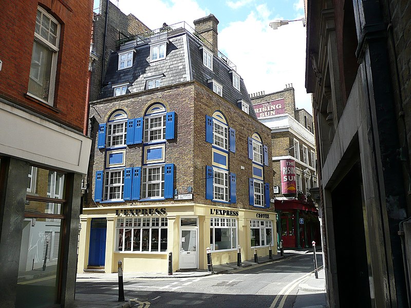
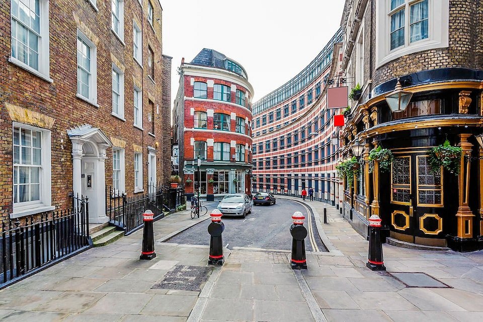
Among the remaining ancient streets, we find buildings of historic interest. Black Friars Lane (formerly Water Lane due to its historical proximity to the Fleet River) follows in part its original, winding path. The main historical building of interest here is the Apothecaries’ Hall, built from Lord Cobham’s house, which in turn was established following the dissolution of the Dominican monastery. Carter Lane, before Ludgate Hill was joined to Cannon Street, was an important East-West roadway. While its eastern extremity (once ‘Little Carter Lane’) now faces a broad open space south of St Paul’s, the western part (formerly Great Carter Lane) retains period charm and the narrow width typical of pre-modern streets. St Andrew’s Hill rising from Queen Victoria Street to Carter Lane also follows a serpentine pattern and retains historic buildings in its upper portion. Just east of there, debouching into Carter Lane, is Wardrobe Place, the former location of the Royal Wardrobe before the Great Fire (which also gave the name to St Andrew by the Wardrobe, facing Queen Victoria Street). It has been labelled as “the quietest place in London” in recent times, due to its secluded location.
Classical buildings of interest
- Apothecaries’ Hall (Black Friars Lane)
- St Paul Choir School (36 Carter Lane)
- Wren House (15 Carter Lane)
- 1-2 St Andrew’s Hill
- 35-36 St Andrew’s Hill