Including Bucklesbury
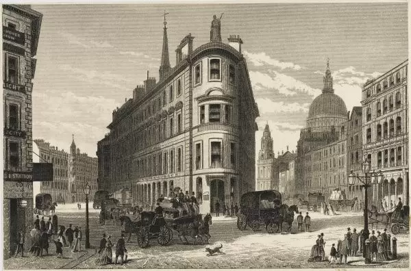
Queen Victoria Street is one of the thoroughfares carved out by the Victorians to improve traffic flow and connectivity in the City of London. It links Victoria Embankment and Blackfriars Bridge to Bank Junction. The two main streets that intersect it are Cannon Street and Queen Street. Queen Victoria Street was proposed no later than 1861 and approved in 1863 as part of the Metropolitan Improvement Act. Construction began in 1867 and was completed in 1871. Due to the substantial gradient between the Embankment and Bank Junction, the street was made to curve gently so as to add length and therefore decrease steepness, resulting in a single street of nearly 2/3 of a mile, at a net construction cost of over 1 million pounds. From west to east, it touches the wards of Castle Baynard, Queenhithe, Vintry, Bread Street, Cordwainer and Walbrook. Another construction challenge was presented by the fact that the District Railways was dug beneath the western portion of Queen Victoria Street.
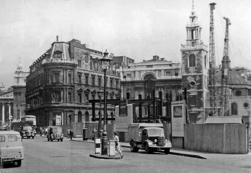
The National Safe Deposit Box building and St Stephen Walbrook are shown, together with construction following substantial war-time damage to the area.
Cutting through a maze of existing minor streets and courts, Queen Victoria Street resulted in the disappearance of Five Foot Lane, Dove Court, Old Fish Street Hill, Bristol Street, White Bear Alley and White Horse Court. Streets that were substantially reduced include Lambeth Hill, Bennet’s Hill and St Peter’s Hill. A particularly ancient street that was truncated by the new road was Bucklesbury. The name refers to a medieval aristocratic estate with manor, there, for the politically prominent Bokerel (or Bukerel) family. It was later the location of Thomas Moore’s house, where Erasmus was a guest. The area later became a centre for apothecaries and herbalists (mentioned in Shakespeare) in the 17th C. and for the sale of luxury goods in the 18th C. The northern part of Bucklesbury survived the creation of Queen Victoria Street only to disappear under the No. 1 Poultry development.
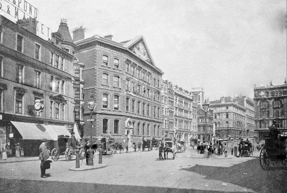
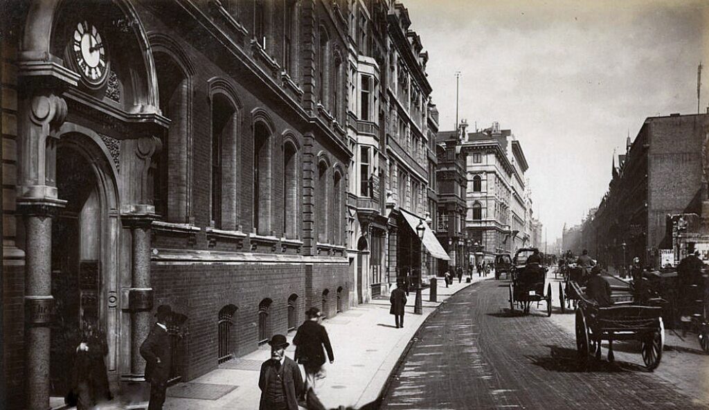
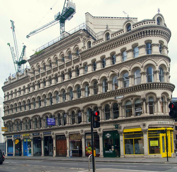
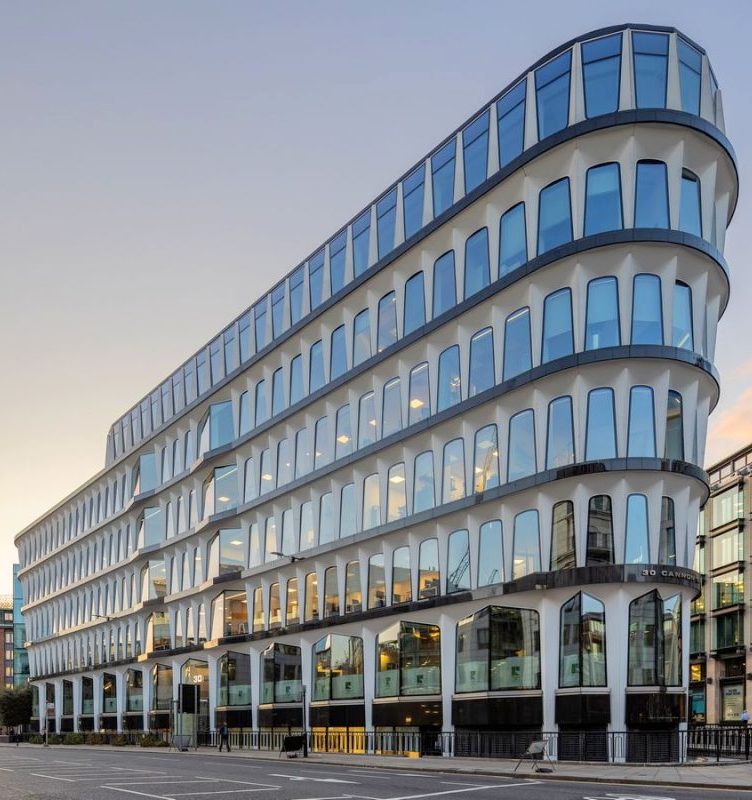
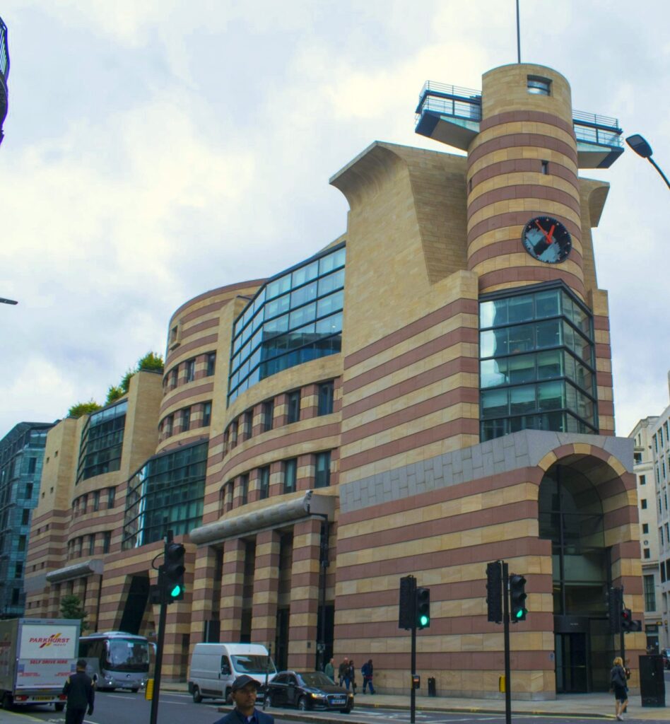
Queen Victoria Street over the decades seems to have attracted more than its fair share of architectural innovation and controversy. The diagonal SW-NE direction of the eastern portion of Queen Victoria Street cut through exiting roads at a sharp angle, leading to many triangular plots that survive today, even when the original buildings do not. The collection of early 1870s buildings that lined it ‒ largely in historicist styles inspired by Gothic, ‘Venetian’ and medievalist themes ‒ were criticised as overwrought and in poor taste by many coeval commentators. Despite this, the overall effect was generally successful. The first major wave of reconstruction and alteration took place after WW2, partly due to extensive bomb damage suffered during the Blitz. Bucklesbury House, a vast 1950s Bauhaus-style complex was the fist in the City to disregard the street line entirely. Next door, Temple Court followed its example in the early 1960s. Both have since been demolished and replaced by an even larger, rather lumpy headquarters complex for Bloomberg. The 1970s saw further change. At the western end, the dire brutalist block of Baynard House was to be integrated with the ‘pedway scheme’ of separation of pedestrian and vehicular traffic. Further along, the much more admired (and, indeed, Grade II-listed) former offices of Credit Lyonnais introduced glass fibre-reinforced cement construction and an interesting transitional aesthetic between Modernist minimalism and Post-Modern whimsy in the shape of its arched windows.
The greatest architectural controversy in this vicinity, however, remains the proposed Mansion House Square scheme. The project foresaw razing the entire area delimited by Queen Street, Queen Victoria Street and Cheapside-Poultry, which included the triangular plot occupied by the well-established Mappin & Webb Building. This was to be replaced by a large, curtain-walled, rectangular tower raised on piers by Mies van der Rohe, very much in his trademark style and a scaled-down version of the bronze-coloured Seagram Building (of New York). An open plaza, again in characteristic mid-century fashion, was to extend in front of the building. After considerable controversy and debate, planning permission for the scheme was withdrawn and, following considerable delay, what did get built (in the 1990s) was an equally iconic, Post-modern building. This hewed to the triangular plot, unliek the Meisian plan, and was designed by James Stirling in 1979: No. 1 Poultry. The contrast in style and programmatic approach between the two projects as well as the extended row over the project remains a sore point in the collective memory of the Modernist movement in Britain.
Classical buildings of interest (east to west)
- National Safe Deposit, now City of London Magistrates Court, (1 Queen Victoria Street)
- 68-72 Queen Victoria Street
- St Mary Aldermary
- 74-82 Queen Victoria Street
- St Nicholas Cole
- College of Arms (130 Queen Victoria Street)
- Faraday House, also: Faraday Building (142 Queen Victoria Street and 1 Knightrider Street)
- British and Foreign Bible Society (146 Queen Victoria Street)
- St Andrew by the Wardrobe
The opening of Queen Victoria Street in 1871 was not universally welcomed as this piece attributed to Arthur (Oswald) Barron (1868-1939) Herald and Antiquary, attests: “May God bless the name of our old Queen ! It was given to some ugly work in the early seventies. To none uglier than this. A man’s heart might sink as he walked that new way, so broad, so convenient for all traffic of wheels. Not a house of all those sad and respectable houses which could rejoice the eye or the heart, unless it were a church or two lingering yet. But the old Heralds’ College stands, saved by a miracle of good luck”
Heralds of England P.492 (Wagner).
Indeed. The new architecture and the rather brutal insertion of this broad street were met with criticism by many.